I turned in my seat and looked rearward. Cape Girardeau Regional Airport slowly receded as we gained altitude. The Mississippi River angled away from our direction of flight. Further in the distance, the Bill Emerson Memorial Bridge, with its signature H-bone pylons, dominated the receding view. The city of Cape Girardeau splayed out on one side of the bridge; Illinois on the other.
Fun fact – you may very well have seen this very bridge. The 2014 thriller ‘Gone Girl’ was filmed in Cape Girardeau, and the bridge was featured – as well as several local haunts. I’ve had a beer at The Bar, and Port Cape features the best barbeque I’ve ever put in my mouth. There are quite a few photos of Ben Affleck scattered around the Cape Girardeau Regional Airport. In fact, on one of my earlier visits to Cape Girardeau, I nearly got into a bar fight with a belligerent drunk who had convinced himself that I was Ben Affleck.
I’m sure Ben Affleck appreciates the compliment.
Getting into bar fights and Hollywood movies were the last thing on my mind as I faced forward. I keyed the headset as we continued to climb, and checked in with Paul, “You good back there, DEWD?”
Paul replied, “Yee-ap!” And added, “Must be a pretty bad headwind. Looks like we’re barely moving.”
Paul was right. We were still climbing, which hindered our forward progress. But, as I looked down and viewed the earth, I could see we were barely creeping along. Using the leading edge of the wing as a guide, I could see cars driving down roads that were boasting better forward progress than we were. I felt a knot well up in my stomach – this flight to Corpus Christi was going to take forever.
“Yeah, it should get better once we level off.” I didn’t feel as confident as I sounded. Sitting back and taking it all in, the view was gorgeous. We were coming up on 2,500 feet, and the open-cockpit PT-19 offered 360 degrees of unobstructed observation. We were flying southwest toward Arkansas. At 7:00 in the morning, the air was cool, but comfortable. I was wearing jeans and a light sweatshirt, which offered all of the protection I needed.
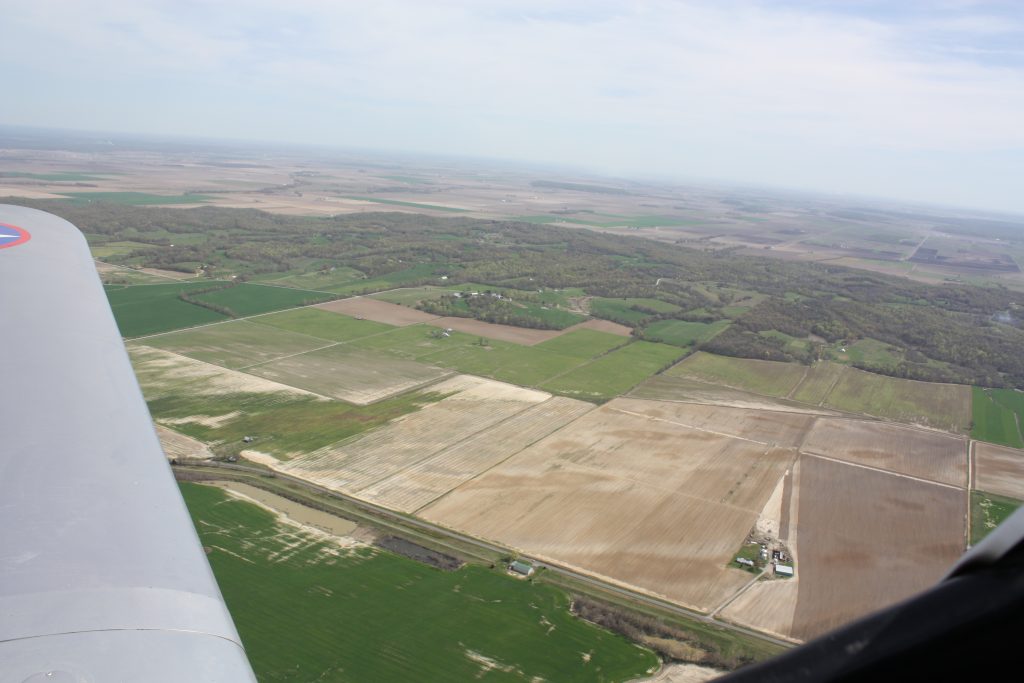
Farmers were beginning their spring tillage. In some spots, I saw corn planters getting prepped. The trees had already erupted into yellow-green blossoms, and the pasturelands and waterways had greened up totally. Spring flying is always a treat, and this morning’s departure was no exception. I leveled the airplane off at 2,500 feet and scanned the gauges. Everything was running normal, so I ducked my head beneath the slipstream to concentrate on the steady rhythm of the engine. No hiccups, and no coughs – the Ranger roared with a solid resolve, as though it was as determined to make it to Corpus Christi as I.

Still, there was a significant malice hiding in plain sight. The budding leaves of the trees hinted of its presence. It was revealed by the waves rolling across the glistening bodies of water, and the smoke from the scattered brushfires. The dust stirring beneath the cars and getting kicked up by farm equipment betrayed its authority. That infernal headwind! The dust, the leaves, the smoke, and the waves all indicated with absolute certainty that we were heading directly into the wind. I could tell it was strong on the ground by the way the dust and smoke crept horizontally. It would only get worse the higher up we flew.
I glanced down at my GPS to gauge our progress. Nothing prepared me for what I saw. Our groundspeed was a record-shattering 36 miles per hour. I did a quick calculation in my head – the PT-19 cruises at 105 miles per hour. If we were only tracking 36 miles per hour on the ground, that meant we were fighting a headwind that was roaring at 70 miles per hour.

Unbelievable! I’d flown in headwinds and tailwinds and crosswinds before, but never anything like this. On the ground, the wind was only 15 miles per hour – gusty, but certainly within the parameters of being able to fly. Two thousand feet up, that same wind had exponentially ballooned to 70 miles per hour. I sat back and weighed my options. The flight was actually quite smooth. Every once in a while, a gust would buffet the PT, but nothing terrible. Landing would not be a problem – I had checked the forward areas of our route, and no airport along the way was reporting winds on the ground in excess of 15 to 20 miles per hour.
I glanced down at the ground, using the leading edge of the wing as a point of reference. On the ground, a car pulled out of a residential drive just forward of the path of the wing. The wing slowly overtook the car. Within seconds, the car emerged from beneath the wing and effortlessly drove on ahead. We couldn’t even keep up. This was humiliating, and I glanced again at the GPS. Our time enroute had exploded from an estimated 8 hours, to nearly 20. At this rate we would never make it to Corpus Christi by dusk.

I announced my thought process to Paul, “Hey DEWD, this headwind sucks. I’m going to go down to about a thousand feet to see if it’s better there.”
With that, I nosed the PT towards the earth. Our groundspeed picked up, ticking hours off the estimated time enroute. If only I could maintain this speed all the way to Texas without running out of altitude! Southeast Missouri lies about 300 feet above sea level. By diving down to 1,000 feet, Paul and I would be flying only about 700 feet off the ground. We would be avoiding any major urban areas, and most of the towers on our path were a couple hundred feet shy of our flight. I enlarged the view on our GPS, and crosschecked with what I saw on the ground. The roads, small country towns, obstacles and towers all mirrored what my GPS was telling me.
Without any prompting Paul announced, “Looks like there’s a tower ahead, just off to the left.” Paul was fiercely opposed to using a GPS, or any technology for that matter, and so followed along on a paper map. We had traced our route prior to departure, so he could navigate as effectively as I. Working together as two sets of eyes; we both relished this new twist to our journey.
I altered our path as needed to avoid obstacles and cities, but I found myself enjoying the adventure. Our groundspeed had shot up to anywhere from 57 to 73 miles per hour, shaving hours off our estimated time enroute. We would not make it to Corpus Christi until late afternoon, but the trip was certainly doable.

Using my GPS, I checked the weather along our path. Paul took control of the airplane and held us steady. The wind was forecast to die down as the day progressed, and tomorrow’s weather outlook included thunderstorms along our route. I felt confident to press on. We would burn more fuel and more oil, and would have to stop a couple extra times, but I thought about a saying my dad used to sing, “When you have time to spare, go by air!” Meaning, don’t fly an antique airplane someplace if you are in a hurry. How appropriate!
We crossed into Arkansas, running parallel along a state highway. Using the leading edge of the wing as a guide, I could see that we were steadily overtaking traffic. This was much better! Paul called out another tower, and I veered slightly right. The tower passed quickly off to our side, a good 200 feet below. It looked like a needle sticking out of the earth.
The state highway emptied into a small town. I flew overhead, looking down at a collection of lives that I would never be a part of. Here and there, I could see people working outside. Some were hunched over their landscaping, while others pushed lawnmowers. A few women strolled with baby carriages.

A few people stopped what they were doing and looked up. I imagined the scene from their point of view. Suddenly, a noisy grey airplane with vintage military markings thunders overhead. It is much lower than airplanes usually fly. Is something wrong? Is there an airshow somewhere? Maybe I’ll think to ask my relative next time I see them. They fly. Maybe they’ll know something. Oh well, the airplane is gone now. Back to whatever it is I am doing.
One man in particular stood out to me. He was working in his yard, and stood up to watch as we passed overhead. It was cloudy, so he didn’t even have to shield his eyes from the sun. He just stood there, and we watched each other in those brief few seconds.
I raised my hand and waved from the cockpit as we passed overhead. He raised his hand and waved back. And then, he was gone. The town dissolved into farmland. The state highway resumed its crawl. We were still overtaking traffic. Still, I thought about the man in the yard. I liked that our two worlds were briefly connected.

Maybe that connection is what we’ve lost?